Sacramento International Airport (SMF)
Click the map to go to Google Maps satellite view of this airport
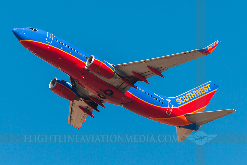
The main airport in California’s capital city doesn’t get a wide variety of traffic but does have some spots that make viewing and photography possible. The largest airlines at the Sacramento Airport are Southwest and United (both mainline and United Express regional jets); other airlines here include Delta & Delta Connection, American, Jetblue, and Alaska Airlines. As far as international or long haul flights, both Hawaiian and Alaska Airlines fly non-stop to the islands using Boeing 767 and 737 equipment and Mexican low-cost airline Volaris flies the A320 to Guadalajara. There is also a fair amount of freight traffic here with numerous daily FedEx and UPS flights.
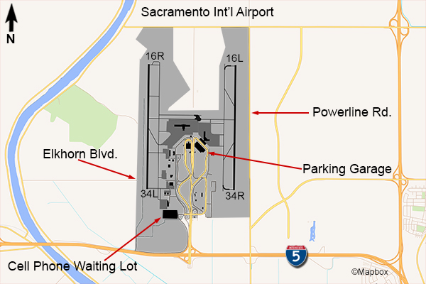
Sacramento’s runway layout is north-south and there are spots that are good for both morning and afternoon sun. The airport is located off of Interstate 5 northwest of the city. For traffic using the east runway, there is a two lane road that runs the length of the field called Powerline Rd. There is no exit from the highway for this road; you’d have to get off at the airport exit (528) and take the south service road east for a mile, then go left on Powerline. This road runs parallel to the runway and there are a couple of spots where you can pull off to watch the planes. Its not a real busy road and the shoulders are not too wide – also on the west (airport) side there is a ditch. It is best to pull off on the east side – you’ll still be able to photograph planes without a long zoom lens as long as they’re over the fence. Photos here would be best in the morning since you’ll be facing west.
Here is an example of a photo from Powerline Rd (click for a larger view).

If you want to photograph traffic using the east runway in the afternoon, the spot would be the roof level of the parking garage. Due to the location of the garage, the only part of it that will offer a decent view is on the northeast side near terminal A (Delta, Jetblue, and United). You’ll have a fairly close view of the ramp near gates A1 & A3 and the taxiway & runway beyond that.
For the west runway, to get a good view in the morning hours the Sacramento airport has a free cell phone waiting lot that is near the south end of this runway. Take the airport exit from I-5 and take the first exit from Airport Blvd on Crossfield Drive and follow the signs. You won’t be able to see planes actually on the runway but you will be able to get decent photos of planes departing to the south or approaching to land from the south without more than 300mm zoom. For afternoon photos there is a spot off the airport property on the west side. It is a road that dead-ends at the airport fence. To get to Elkhorn Blvd, from the cell phone lot take N. Bayou Rd south to the highway and west to the end at Garden Hwy, which runs along the Sacramento River. Make a right here and go to Elkhorn Blvd, which will be the first street. Then, its over a mile east on Elkhorn to the end. You will be near the threshold of runway 34L so you’ll be able to see planes turning onto the runway and departing as well as landing. Again, all without a long zoom lens. One thing to keep in mind about photos at Sacramento (and most places in California), during the summer months there will be bad heat distortion when photographing anything near the ground.
Here is an example of a photo taken from Sacramento’s cell phone lot in the morning: