Metropolitan Oakland International Airport (OAK)
Click the map to go to Google Maps satellite view of this airport
The Oakland airport is the San Francisco bay area’s 2nd largest. Most of the domestic airlines that operate at SFO also operate here and this is a major destination for Southwest. There is very limited international service. Mexican low-cost airline Volaris flies here from several cities in Mexico using A320 equipment. There is also significant cargo traffic from FedEx and UPS all day as their sorting centers are located nearby since it is less congested than SFO.
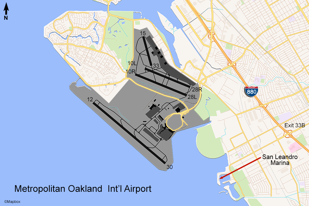
The real challenge is finding a place to watch and/or photograph aircraft at Oakland. There are somewhat limited opportunities due to the layout of the airport. OAK is located on the east side of the bay, so the best photography will be in the morning. There’s just one problem: the ever-present fog layer that covers San Francisco and the bay until mid-morning. The best location is the San Leandro Marina just southeast of the field. Exit the I-880 freeway at Marina Blvd (33B) and go west. You’ll come to the marina, and then turn right on Mulford Point Dr. This will take you around to the back of the marina at the edge of the bay where there are plenty of free parking spaces. The approach path to runway 30 passes fairly close – you won’t need a long zoom lens. Photographing planes on the runway won’t be possible because of the distance and heat distortion but you will get a decent view of all the airline traffic landing here. The shorter runways you see on the map are only used for general aviation traffic (which there is a lot of too). I shot the pictures below during the late morning hours around 11:00am. The fog had begun to lift but the background was still solid overcast. This is typical of Oakland during certain times of the year.
I was curious to see if there was any location at all that would be possible to shoot from the west as I really wanted a shot of a Norwegian Air Shuttle 787 which was due to arrive at around 5:00pm. A couple miles south of the marina is highway 92 leading to the San Mateo Bridge. On the north side service drive just before the bay there is a nature center called the Hayward Shoreline Interpretive Center. If you turn around so you are facing east, the approach path for runway 30 crosses this highway about a mile east of this spot. It is a little distance, and the aircraft will probably be around 3,000 feet but a large plane like a 787 or a widebody freighter may be large enough to frame up using a long zoom lens. I was not able to try it though.
If conditions don’t allow for good pictures you can also visit the Oakland Aviation Museum located on Earhart Rd. on the airport property, just off the main airport entrance road.
