Atlanta – DeKalb-Peachtree Airport (PDK)
Click the map to go to Google Maps satellite view of this airport
Atlanta’s DeKalb-Peachtree Airport is one of the best general aviation airports that I have been to for aircraft viewing and photography, and is one of the busiest general aviation airports in the country. It is located in the northeast Atlanta metro area off of I-85, about a half hour drive from the Hartsfield Airport.
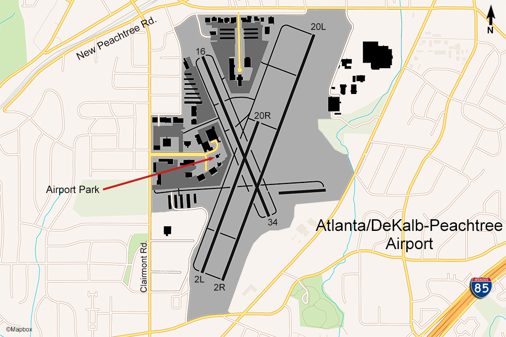
There is an airport park located at the end of Airport Rd. right behind the PDK control tower. It is very family and picnic friendly with tables, restrooms, childrens’ play area, and a raised concrete stadium-style seating area right up by the fence. From the top row, you will be looking above the fence and will have a clear view of all the activity. Aircraft will be taxiing past this area on their way to the runway or the fixed-base operators (Signature and Atlantic Aviation). This park is located right in the middle of the airport (see map above) near the crossing of the two runways. You’ll be facing east when looking at the planes so photography is excellent in the afternoon any time of the year.
Most of the planes you will see here will be business jets and small private planes. There is no airline activity here, but Atlanta’s PDK Airport is the 2nd busiest airport in the state of Georgia.
Examples of Photos From This Location
Examples of Photos
