Chicago Midway International Airport (MDW)
Click the map to go to Google Maps satellite view of this airport
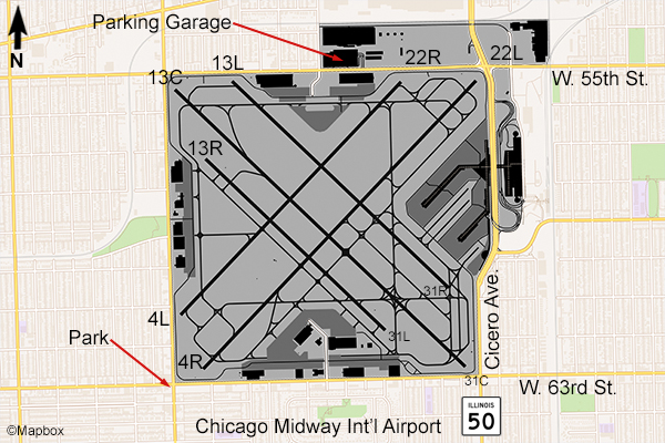
Chicago’s Midway Airport is another one that can be tough to photograph from. The field is surrounded on all four sides by various airport businesses and collapsible walls at each corner as noise and blast barriers. There is a very small park on the southwest corner at the intersection of W. 63rd & S. Central Ave (see map) that will give a great view of planes approaching runway 4R. Parking can be difficult here, since it is in a crowded urban area.
A better choice would be Midway airport’s economy parking lot and garage located on W. 55th St. From the top of this 7 floor garage you can get a very good view of planes landing on runway 22L or 22R, or holding in position for takeoff on those runways. If they’re taking off on 4L or 4R, they may be too high unless you have a longer lens. Being a few floors up allows you to see over the concrete wall that runs along W. 55th St. Since you’re facing east from here, photos are best in the afternoon to evening all year.
Most of the traffic here is of the Boeing 737 type with Southwest the largest airline so there isn’t a large variety. Other airlines here are Frontier, Sun Country, and Delta (mainline and Delta Connection) as well as business & general aviation aircraft. Midway is not the best airport to photograph from, but due to the close proximity of O’Hare (only about 20 minutes by car) it would be possible to visit both in one day and see much more variety.
Examples of Photos
