Raleigh-Durham International Airport (RDU)
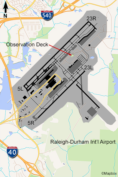
This airport is located midway between Raleigh and Durham in North Carolina and has an Observation Park, built in 1997, that is located within good viewing distance of RDU’s longest runway 5L/23R (10,000 feet) on the west side of the airport. This park is free and has a covered two-story tower with Air Traffic Control frequencies on a speaker, picnic tables, kids play area and is safe and easily accessible. You’ll only be able to see traffic on one of RDU’s two runways from here, and photography would be better in the early part of the day since you face north and west. Also, your view of the south end of this runway may be blocked by trees.
The Raleigh-Durham Airport is served by all the major U.S. airlines, and the only international service is Air Canada Express flights to Toronto. The largest airlines here are United/United Express and Southwest. Overall, its a well-planned and nice looking Observation Park but not a very active place.
Examples of Photos
