Salt Lake City International Airport (SLC)
Click the map to go to Google Maps satellite view of this airport
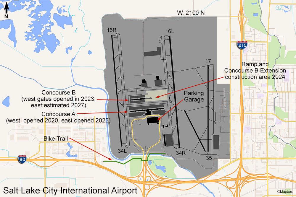
The main airport in the state capitol of Utah has three spots where you can view aircraft activity. The first is along a road that runs across the north end of the field connecting the I-215 freeway to the airport control tower. It is a two-lane lightly traveled road and you can pull over on the shoulder on either side of the centerline of runway 16L/34R.
The second area is the highest level of the parking garage. The nearest aircraft activity will be on the east ramp so the light for photography here would be good in the afternoon. Due to the orientation of the garage you probably won’t be able to see much of the activity on the west runway or ramp.
The third spot at the Salt Lake City airport is a bike/jogging trail that begins at the Hyatt Place hotel at the end of Tommy Thompson Rd. on the southwest corner of the airport property and goes completely around the south end of the airport. Actually, this bike trail connects to a larger bikeway that covers the entire city! You’ll have to walk the trail a little bit and you’ll be right near the extended centerline of runway 34L. You can get a good close view for photographing from here. The only downside is that there’s no place to sit if you’re going to stay a while and no place to take shelter if a storm should come up. You would have to walk back to the hotel parking lot.
The largest airlines at the Salt Lake City airport are Delta, Frontier, and Southwest. Aeromexico operates daily flights to Guadalajara. SLC is also an Air National Guard base flying the KC-135 tankers. You’ll see some cargo airlines as well, including UPS and FedEx. The Salt Lake City airport is a very aviation enthusiast-friendly place and is definitely worth visiting if you are in Utah.


