Louisville Muhammad Ali International Airport (SDF)
The Louisville airport is the home base of United Parcel Service and there’s always a wide variety of UPS planes including 747s – except on Sundays. Passenger traffic is somewhat limited, but the largest airlines here are Southwest and Delta/Delta Connection. Others include United Express, American, and American Eagle.
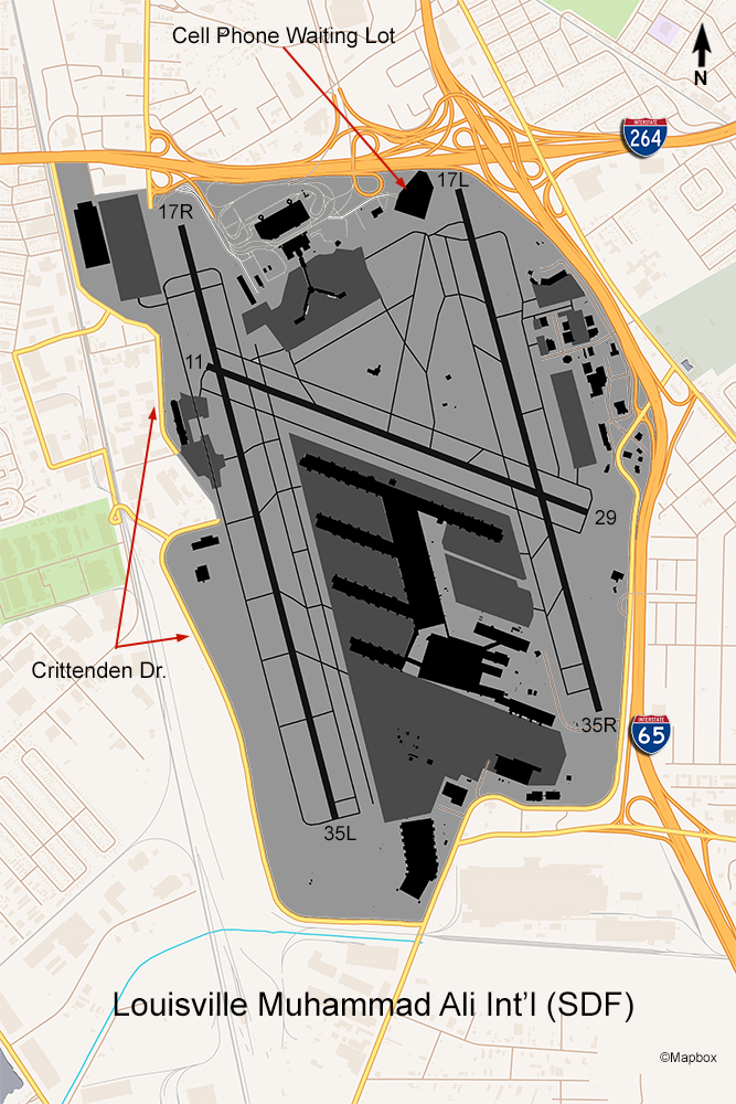
The most reliable spot to view aircraft traffic is the cell phone waiting lot. To reach this spot just follow Terminal Drive to Administration Drive. Turn right there and follow it to the end and look for signs to the Cell Phone Lot. You have to take a ticket at the entrance but up to two hours is free. Photography is best in the afternoon since you’re facing east. Most of the passenger airline traffic uses this runway so you’ll see mostly smaller planes.
The only other areas to see aircraft are on the west side of the airport. There used to be a street called Crittenden Rd. that ran parallel to runway 17R/35L the entire distance but over the last decade parts of that road have been eliminated thanks to a project to build a new taxiway and ramp on the west side. There are a few business parking lots you can pull into on both the north and south sections of this road to get a view of aircraft taking off from or landing on the west runway. The only way to get to the north part of Crittenden Rd. is to go north from the airport under I-264 and turn left on Park Blvd. which will curve around back to the south and become Crittenden Rd. It dead ends at the FedEx building.
The 4th floor of the airport’s only parking garage has a decent view of traffic landing on runway 17R (west side of the airport) but I have not explored this area. The examples of photos below are a typical view from the Cell Phone Lot.
