Washington DC – Ronald Reagan National Airport (DCA)
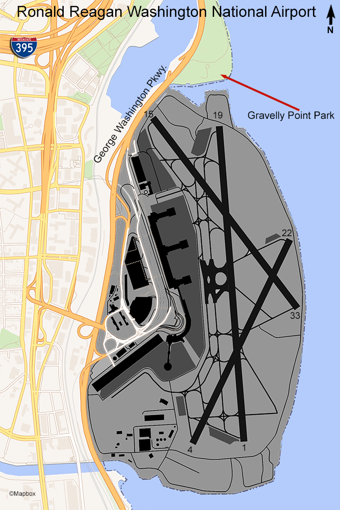
The only viewing area at the Reagan National Airport is located in Gravelly Point Park, which is just north of the airport off George Washington Parkway. Washington DC is across the Potomac River and is a “no-fly” zone so planes approaching runway 19 make a left turn over the park following the river bend. This park is a great place to come and relax whether or not you are watching planes. There are running trails and boat ramps for small boats & jetskis. Planes on approach will be very low and you get a good view of the end of the runway where planes will taxi into position to depart toward the south. Also, planes departing to the north will be low when flying over this park.
The most common type of aircraft seen here are A320, 737, Regional Jets, and turboprops. Reagan National Airport is a hub for American Airlines and its regional affiliates but there are flights from most U.S. airlines. The only international flights are from Air Canada Express using regional jets. This airport operates under a federally mandated Perimeter Rule which bans non-stop flights of more than 1,250 miles with only limited exceptions for 20 daily flights. The various airlines are allotted slots which they can use, sell, or swap. For example, United recently traded a slot to Chicago for an outside perimeter slot to San Francisco.
Overall, this is an excellent choice for planespotting. It’s a safe place and usually very crowded, and there are no entrance or parking fees. The sun angle for photography is good too since you can be on either side of the centerline of the runway on the Gravelly Point jogging trail. It is definitely worth a visit if you are in the Washington DC area.
Examples of Photos
