San Diego International Airport (SAN)
Click the map to go to Google Maps satellite view of this airport
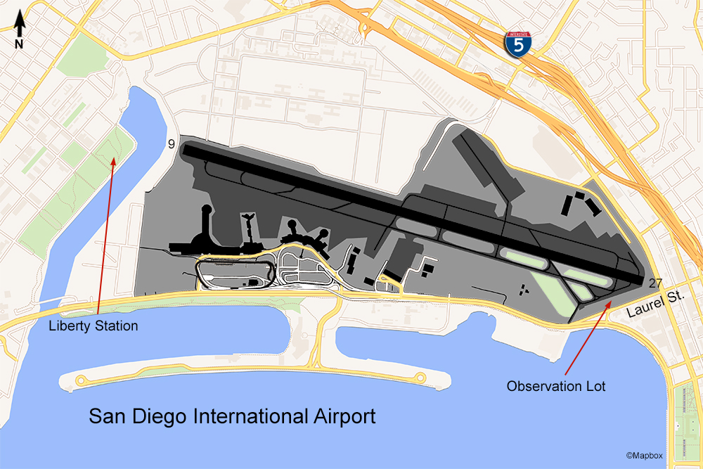
There are pretty much only two San Diego airport planespotting locations where you can get a decent view of aircraft. One is a small parking lot at the intersection of W. Laurel St. and N. Harbor Dr. The view faces the end of runway 27, but there’s a double row of fence so it would be extremely difficult to see or photograph any planes on the taxiway or runway even though they are very close. You will be able to see aircraft approaching for landing; however, in order to get a good photo before the plane goes below the fenceline you have to stand at the right spot in this parking lot. It is possible though, as you can see from the photos at the link below.
The other spot on the west side can give you a view of departing aircraft. There is a development called Liberty Station (sometimes called NTC Park) just across the river from the airport. There is plenty of parking here as well as open spaces in the park. You’ll be fairly close to the runway path so the angle will be more from the bottom as you can see from the examples linked below.
Because of the layout and location of the only runway at this airport, the approach is very steep and the traffic pattern is almost always to the west. Most of the traffic is of the 737 and A320 variety, but there some airlines flying widebodies. Japan Airlines flies a daily non-stop to Tokyo using the 787; Hawaiian flies the A330 to Honolulu; and British Airways flies to London. Given the constraints of the fences it would be difficult to photograph a large aircraft being so close. If you are a passenger, photographing aircraft is much easier from the big windows at the gates in the terminal but each terminal has a separate security checkpoint.

