Savannah – Hilton Head International Airport (SAV)
Click the map to go to Google Maps satellite view of this airport
Although Hilton Head Island (located about 40 miles north) has a commercial airport, this airport serves both the city of Savannah and Hilton Head with larger jets. The main focus is tourism and Savannah’s airport makes a good first impression on newcomers. The terminal was built in the mid-1990s and, unlike other airports that simply added to an existing structure, Savannah built a completely new single concourse terminal and parking structure. It looks new and fresh and was designed with some of the old south charm in its appearance.
The largest airline here is American with service to Dallas, Charlotte, Philadelphia, and Washington using regional jets as well as mainline Airbus A320 jets. Delta has flights to Atlanta, New York, and Detroit and typically uses 737 and 717 jets. United Express flies to Houston, Chicago, Newark, and Washington. This airport is also served by JetBlue, Allegiant and sometimes Sun Country.
The Savannah airport is also the home of Gulfstream Aerospace and their business jet factory so at any given time you may see brand new jets being flown on test flights.
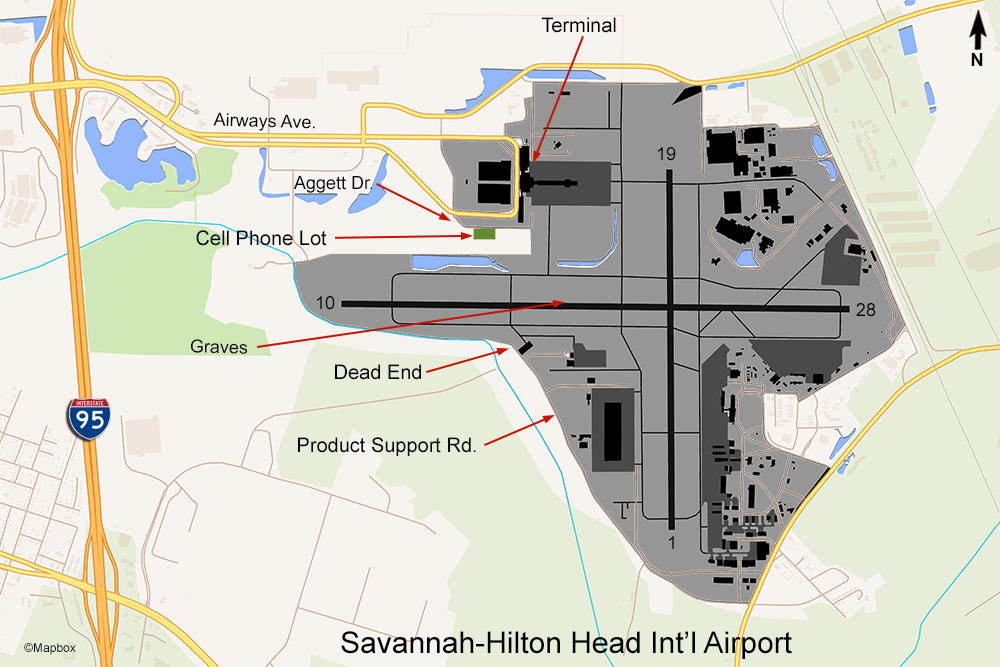
Interesting fact: this is the only airport in the world that is known to have marked graves embedded into an active runway. See the map above. In the 19th century this area, known as Cherokee Hills, was home to the Dotson family farm. The family had a cemetery that grew to over 100 graves. By the 1940s there was an airfield on part of this land, and the U.S. Army needed to acquire more acreage to expand the field. As part of the land purchase the family descendants agreed to move most of the graves to another cemetery in Savannah but demanded that the graves of the original settlers Richard and Catherine Dotson, along with Daniel Hueston and John Dotson, remain undisturbed. So, when runway 10/28 was expanded during the 1940s they simply embedded the markers in the asphalt of the north side shoulder. They are visible on Google Maps satellite view and more detailed images can be found online as well as on the airport’s own website.
There aren’t too many spotting and photography opportunities here. Two spots have a view of runway 10/28. One is the cell phone waiting lot located on Aggett Drive. To get here you would exit I-95 at the airport exit and follow the road leading to the terminal, and turn right on Aggett, following the sign to the cell phone lot. You’ll be facing south and will have a view of traffic using the east-west runway. Photos from this location will be backlit though, except for summer evenings. Directly across the runway is another spot. To get here, you’ll have to drive all the way around the south side of the airport by exiting I-95 at US 80 East and going to highway 307 and then north up to Product Support Rd. The odd name for this road is due to the fact that it mainly serves Gulfstream’s service and customer center. If you take it all the way to the end, there’s a turnaround right next to the runway fence. You’ll be facing north, so photos will be better earlier in the day.
While there is no observation deck inside the terminal, you can park in the parking garage and walk to the sidewalk outside the terminal doors where, at the end of the building, it overlooks the south ramp where Delta’s gates are.
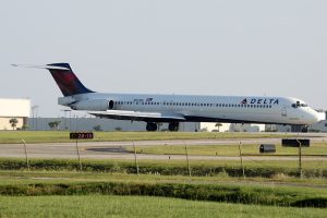
Here is an example of a photo shot from the cell phone lot in the afternoon (click for a larger view).


